a5 - applying current geographic technologies
Identify various technologies used by geographers including:
- GIS - Geographic Information System
- GPS - Global Positioning System
- Remote Sensing (eg. radar, infrared, satellite imaging)
GIS
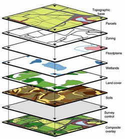
Geographic Information Systems (GIS) use technology to capture, store and analyse geographically referenced information (physical locations)
For a good brief introduction read through the information in the 'What is GIS?' section
http://www.esri.com/what-is-gis
GIS presents information in two ways:
For a good brief introduction read through the information in the 'What is GIS?' section
http://www.esri.com/what-is-gis
GIS presents information in two ways:
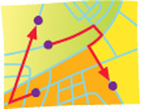
- Vector = uses geographic coordinates to present data as points, lines and polygons
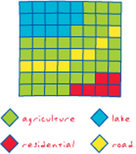
- Raster = presents data in the form of a grid of equally sized cells
|
|
Gps
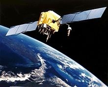
Global Positioning System (GPS) uses satellite technology to assign accurate geographical locations and help people to navigate easily
Read through the sections in this site which explains what GPS is, how it can be used and some potential drawbacks
http://www8.garmin.com/aboutGPS/
Read through the sections in this site which explains what GPS is, how it can be used and some potential drawbacks
http://www8.garmin.com/aboutGPS/
remote sensing
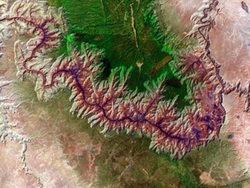
Remote Sensing is a way that Geographers can produce maps without actually visiting the area, sources include satellites, radar and aerial photography
Check out these USGS pages for some examples of remote sensing
http://eros.usgs.gov/#/Remote_Sensing
For some good remote sensing practical materials try downloading these 'Watching over our planet' pdfs
http://www.nrcan.gc.ca/earth-sciences/geography-boundary/remote-sensing/kids/1437
Check out these USGS pages for some examples of remote sensing
http://eros.usgs.gov/#/Remote_Sensing
For some good remote sensing practical materials try downloading these 'Watching over our planet' pdfs
http://www.nrcan.gc.ca/earth-sciences/geography-boundary/remote-sensing/kids/1437
